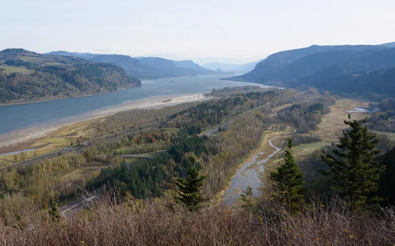
Hood River sits on the Columbia at the east end of the waterfall corridor: a waterfront of almost two miles of trails, county parks in the valley, and, west along the historic highway, Crown Point, Multnomah Falls and the Gorge.
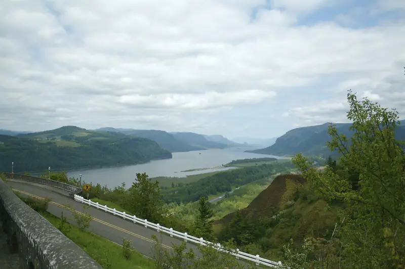
Hood River is a Columbia River town about an hour east of Portland. Official Forest Service pages describe the Columbia River Gorge as a river canyon 80 miles long and up to 4,000 feet deep, the only sea-level route through the Cascade Range. Official Oregon State Parks pages place Crown Point and Vista House 693 feet above the river near I-84 Exit 22, at the start of a waterfall corridor that includes Multnomah Falls.
In town, official city pages list 19 parks and open spaces totaling more than 73 acres. Waterfront Park, on Portway Avenue between 2nd and 8th Streets, has river access, walkways, picnic shelters and an amphitheatre, on close to six acres the Port donated to the city. Official Port pages describe almost two miles of pedestrian trails along the shoreline, with some gaps, and they warn that the Spit and sandbar change with river levels and have strong currents. South of town, official county pages list day-use parks, including Panorama Point and Punchbowl Falls, as open sunrise to sunset, with no overnight camping.
Show
Free No charge to enter · Cheap A small entry, permit or parking fee · Paid Tickets, tours or rentals
Outdoors and nature
Trails, lookouts, waterfalls, beaches and time on the water come first.
Free
Bridal Veil Falls State Scenic Viewpoint
A state park just off the Historic Columbia River Highway near milepost 28, official pages say, with two short hikes: a steep 0.3-mile trail to the base of a two-tier fall of about 120 feet, and a half-mile paved Overlook Trail with views of the Columbia. Official pages warn not to walk on the highway bridge to see the falls. Picnic tables and restrooms are near the parking area. Access is from I-84 Exit 28.
A city park on the Columbia River, on Portway Avenue between 2nd and 8th Streets, official city pages say, with waterfront access and walkways completed in June 2008, a restroom and playground dedicated in June 2009, picnic shelters, off-street parking and an amphitheatre. Official Port pages describe it as close to six acres donated by the Port to the city.
Much of Hood River's waterfront shoreline is owned and managed by the Port of Hood River, official Port pages say, with close to two miles of pedestrian trails, some of them with gaps. The Hook is described as a recreation site for watersports, with a protected cove. Confirm current access and any event or parking notices before you go.
A Port park of lawn, open space, beaches and trails, official Port pages say, including Marina Beach, Marina Green, a picnic shelter and the marina's public boat launch. Confirm current access before you go.
A Hood River County day-use park. Official county pages say day-use parks are open from sunrise to sunset, the gate closes daily at sunset, overnight camping is prohibited, pets must be leashed, and restrooms are available April through October. Reservations are not accepted.
Season Official pages say day-use parks are open sunrise to sunset, and the gate closes daily at sunset. Restrooms were listed as available April through October (check before you go).
A Hood River County park acquired in April 2016, official pages say, with minor amenities added in 2019. There is no fee. The park is open during daylight hours only. Overnight camping is prohibited. Visitors are asked to follow pack-in, pack-out rules. There are no public restrooms. Pets must be leashed. Parking is limited.
Season Open during daylight hours only. No restrooms, no fee, limited parking, pack-in pack-out (check before you go).
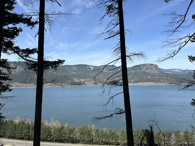
A river canyon 80 miles long and up to 4,000 feet deep, official Forest Service pages say, the only sea-level route through the Cascade Range, with cliffs, spires and ridges set against nearby peaks. Confirm current fire restrictions, trail conditions and any pass requirements before you go.
Season Confirm current fire restrictions, trail conditions and any pass requirements before you go.
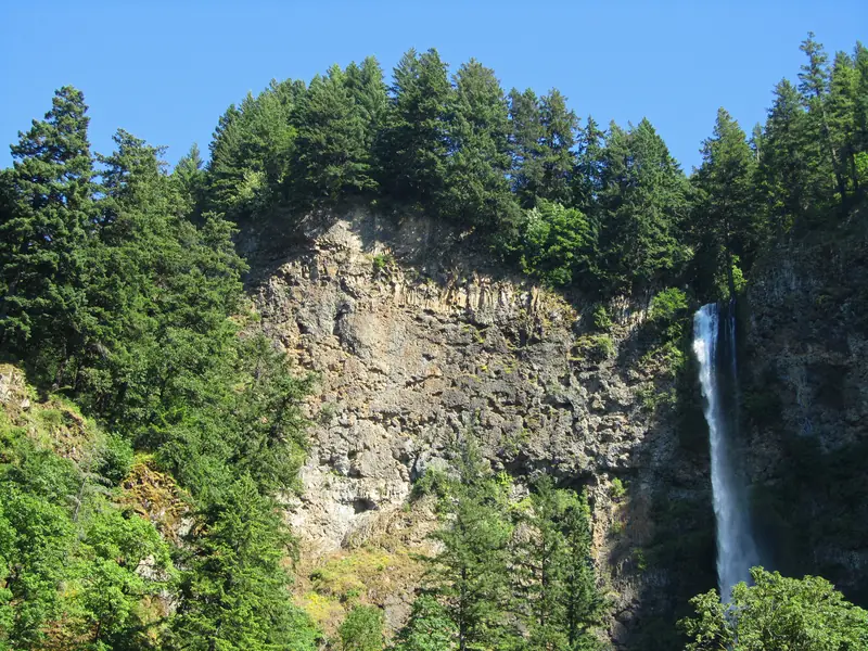
A 620-foot waterfall in the Columbia River Gorge National Scenic Area, official Forest Service pages say, fed by springs from Larch Mountain, with more than two million visitors a year. A steep trail climbs from the visitor centre to the historic Benson Bridge; the walk to the top of the falls and back is 2.4 miles, with about 600 feet of elevation. The site is day-use only and open year-round. Official pages say restrooms are closed for renovation through November 2026, with limited portable toilets on site. Timed reservations are required from late May through early September, 9 a.m. to 6 p.m.; confirm current permit rules before you go. Pets must be leashed.
Season Day-use only, year-round. Official pages say restrooms are closed for renovation through November 2026. Timed reservations are required from late May through early September, 9 a.m. to 6 p.m. (check before you go).
Larch Mountain Trail #441, official Forest Service pages say, is one of the most popular hikes in the Gorge. From the Multnomah Falls visitor centre a steep trail climbs to Benson Bridge; beyond the bridge, the walk to the top of the falls and back is 2.4 miles on uneven, steep terrain. Confirm current trail conditions and any permit rules at the falls before you go. Pets must be leashed. Stay on the trail.
Season Confirm current trail conditions and any permit rules at the falls before you go.
A popular spot on the Port waterfront for walking and kiteboarding, official Port pages say. The size of the sandbar changes with river levels, and official pages warn that strong currents and unpredictable changes in water depth require extreme caution.
Seven Streams Staging Area, official state park pages say, is five miles west of Hood River and a gateway to the Post Canyon Trail System, a network of hiking, equestrian, mountain-biking and ATV trails on a patchwork of state, Forest Service and private land, managed by Hood River County. The staging area is on Vinzenz Lausmann Memorial State Natural Area, 126 acres given to the state. Official pages warn that the entrance road is narrow. Confirm current trail rules and any closures before you go.
Season Confirm current trail rules and any closures before you go.
A state park in the west Columbia River Gorge, official pages say, with access to the Gorge 400 Trail and the Horsetail Falls trail from roadside parking about a half mile west of the campground entrance. The campground was listed as open mid-March through 31 October and closed 1 November through mid-March. Confirm current access and any day-use or camping rules before you go. Pets must be leashed.
Season The campground was listed as open mid-March through 31 October and closed 1 November through mid-March (check before you go).
Museums, landmarks and the places people come here for.
Check price
Crown Point and Vista House
A state scenic corridor near I-84 Exit 22, official Oregon State Parks pages say: a rocky promontory 693 feet above the Columbia, and an octagonal building with a museum, a gift shop and interpretive displays. The viewpoint along Highway 30 was the site of the 1916 dedication of the Columbia River Highway, and it marks the beginning of a waterfall corridor that includes Multnomah Falls. Parking areas are open 6 a.m. to 9 p.m. The corridor is open for day use year-round. Official pages listed Vista House, from 30 October 2026 through 21 March 2027, as open Friday through Monday, 10 a.m. to 4 p.m., and closed when winds exceed 50 mph or in inclement weather.
Season Parking areas are open 6 a.m. to 9 p.m. Official pages listed Vista House, from 30 October 2026 through 21 March 2027, as open Friday through Monday, 10 a.m. to 4 p.m., and closed when winds exceed 50 mph or in inclement weather (check before you go).
Cruises, tours and experiences people book here. Each one goes to the operator's official page, and you can still add it to your trip.
Tickets
Vista House
The octagonal building at Crown Point State Scenic Corridor. Official pages listed it, from 30 October 2026 through 21 March 2027, as open Friday through Monday, 10 a.m. to 4 p.m., and closed when winds exceed 50 mph or in inclement weather. Confirm current hours before you go.
Multnomah Falls: Official pages say the site is day-use only and open year-round, and that restrooms are closed for renovation through November 2026, with limited portable toilets on site. Reservations are required from late May through early September, daily from 9 a.m. to 6 p.m.; confirm current timed-permit rules, and any transaction fees, on the official page before you go. Limited free permits were also listed at the Gateway to the Gorge Visitor Center in Troutdale and the Cascade Locks Historical Museum. Pets must be leashed. Drones are prohibited.
Crown Point and Vista House: Official state park pages say parking areas are open 6 a.m. to 9 p.m., and that the corridor is open for day use year-round. An official advisory, effective 30 October 2026 through 21 March 2027, listed Vista House as open Friday through Monday, 10 a.m. to 4 p.m., and closed when winds exceed 50 mph or in inclement weather. Confirm current hours before you go.
County day-use parks: Official Hood River County pages say day-use parks are open sunrise to sunset, overnight camping is prohibited, and pets must be leashed or caged when outside a vehicle. Restrooms at Oak Grove and Panorama Point were listed as available April through October. The gate at Panorama Point closes daily at sunset. Punchbowl Falls Park is open during daylight hours only, has no restrooms, no fee, limited parking, and a pack-in, pack-out rule.
We list only places we can check against an official source. Hours, seasons and prices change, so confirm before you go.